
Arthur's Way
Choose from the options below
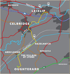
1. Arthur's Way, Leixlip - From Leixlip To Celbridge
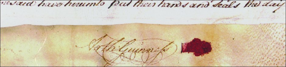
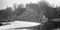 Standing here, you are only a couple of hundred metres from the site of the original Guinness brewery, where the world famous entrepreneur began his life's work.
2. Arthur's Way, Celbridge - From Celbridge To Hazel Hatch
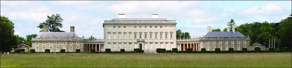
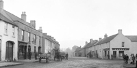 Throughout the 1700s, many more houses sprang up along the approach to Castletown House. One of these was 22 Main Street, which was occupied by Richard
Guinness and his family.
Throughout the 1700s, many more houses sprang up along the approach to Castletown House. One of these was 22 Main Street, which was occupied by Richard
Guinness and his family.
3. Arthur's Way, Hazel Hatch - From Hazel Hatch To Lyons Estate
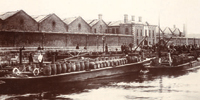 This stretch of Arthur's Way introduces you to the Grand Canal. This feat of 18th Century Victorian engineering allowed the Guinness brewery in Dublin to expand its operations.
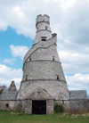
4. Arthur's Way, Lyons Estate - From Lyons Estate To Oughterard
 Arthur's Way continues along the Grand Canal, and takes you into the heart of north Kildare. As you leave behind Hazelhatch and head south-west, you will get glimpses of Lyons Hill amongst the foothills of the Dublin Mountains.
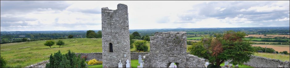
5. Arthur's Way, Oughterard - From Oughterard To Oughterard Cemetery
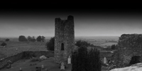 Oughterard (in Irish Uachtar Árd) means high place. It is an apt description. The relatively easy climb to the cemetery is deceptive; when you reach the open ground in the graveyard, you are rewarded with remarkable views of the plain of Kildare and a broad sweep of Leinster to the west, and the Dublin and Wicklow Mountains stretching away to the south.
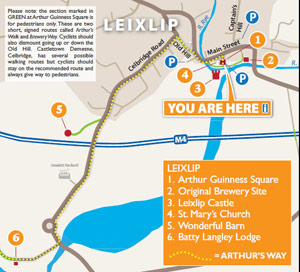
Arthurs Way
 RECOMMENDED ROUTE
POINTS OF INTEREST & DISTANCES
STAGE 1: Arthur Guinness Square, Leixlip
towards...
STAGE 2: Celbridge Main Street
towards...
STAGE 3: Hazelhatch Bridge
towards...
STAGE 4: Lyons Estate
towards Oughterard
![]()
LENGTH: 16km approx.
TIME: 3-3.5 hours walking; 1-1.5 hours cycling
GRADE: Easy. Generally flat with good surfaces. Inclines at Old Hill, Leixlip and
Ardclough. Mix of footpaths, tracks, roads and canal towpath. Suitable
for family groups. Normal outdoor footwear can be worn.
Arthur's Way is a waymarked linear route which can be enjoyed in either direction.
 Keep an eye out for the Arthur's Way information boards, fingerposts and marker posts to help keep you on track
PUBLIC TRANSPORT
To and from LEIXLIP:
Dublin Bus - all 66 routes
Irish Rail - Maynooth Suburban Line
To and from CELBRIDGE:
Dublin Bus - all 67 routes
Irish Rail - Portlaoise Line
www.dublinbus.ie
www.irishrail.ie
www.transportforireland.ie

Log on to the website to get more
information on the route, including
MAPS and LEAFLETS, and an AUDIO GUIDE.
www.ArthursWay.ie